Using GPS data to track leopard’s prey preferences

Training tour for anti-poaching units
June 30, 2017
Leopard predation in Golestan
July 5, 2017
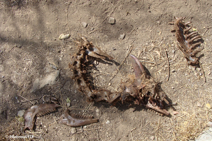
Leopards are carnivores, but how much food do they need to meet their energy requirements? Equally important, what types of prey do they kill more often? These are crucial questions which, among others, we are trying to explore using the GPS satellite collar data we retrieve from leopards.
In Tandoureh National Park, in partnership with University of Oxford’s Wildlife Conservation Research Unit (WildCRU) and Panthera, we have launched the first ever comprehensive ecological study on Persian leopards to address some key gaps in our knowledge, including leopard foraging behaviour. Each collar takes a GPS fix every one to three hours, which will be transmitted via satellite as part of a batch every few days. When several GPS fixes come from a single location, such as a valley bottom or among trees, we visit the site to investigate what the leopard was doing there. We call these grouped fixes a “cluster”.
Visiting a cluster does not always result in finding the remains of a kill – often they are just places where the leopard has taken a rest or looked out for prey from some concealed spot. Almost one-third of clusters do however have kills, which we are keen to record. At each kill site, we need to identify the prey species, its age and sex, and the remains. Sometimes what is left is not a complete carcass but, for example, a wad of hair, which will be used in later lab investigations to reveal the species. This information about the prey will enable us to quantify the food needs of leopards in these montane landscapes.